Use the interactive map to assign or modify geographic territories if you used the bucket method, or if you want to edit territories created from a template.
Use one of the following interactive methods to assign a territory on the map:
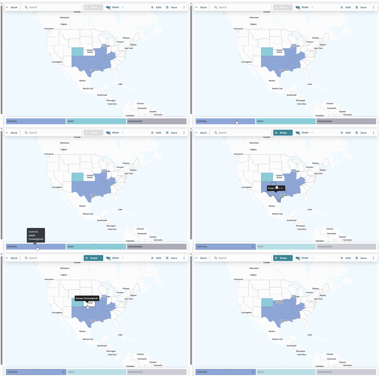
Point and click
Use this option to assign distinct, individual areas like states or specific postal codes.
Click the desired territory at the bottom of the map.
Select the boundary data level (for example, State or 5-digit zip) you want to assign.
Click directly on the geographic areas (for example, states or postal code areas) on the map that you want to assign to the selected territory.
Note
Selected areas will highlight in the color associated with the active territories.
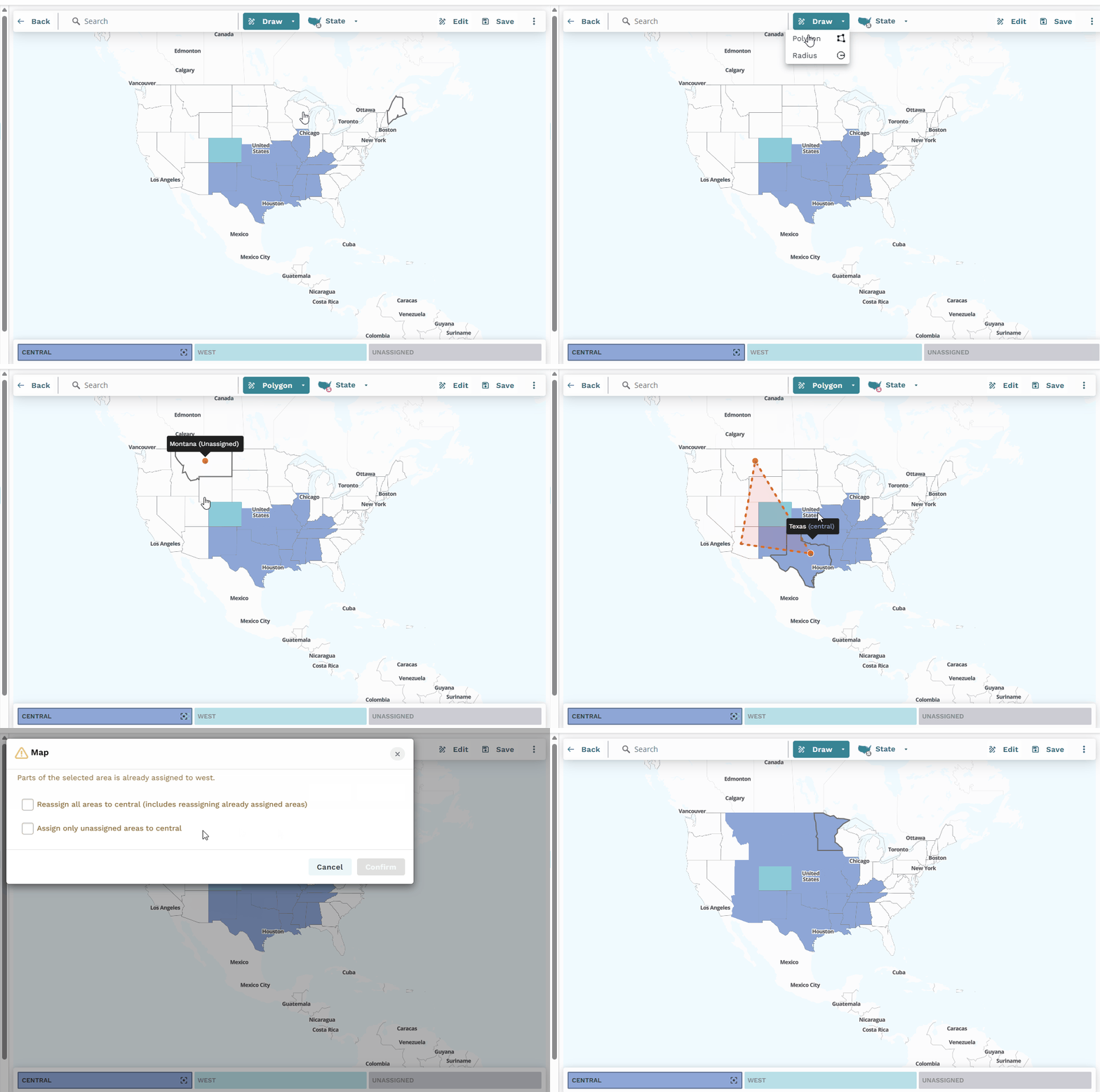
Draw polygon
Use this option to select a custom-shaped cluster of geographic areas.
Click the desired territory segment at the bottom of the map.
Select the Map Zone Level you want to assign.
From the Draw dropdown on the map interface, select Polygon.
On the map, click where you want the starting point of your territory.
Click to define the corners (vertices) of your polygon to outline the area.
Click again on the last point of the polygon to complete the polygon.
Note
All geographic areas within the drawn polygon at the selected map zoom level will be assigned to the active territory.
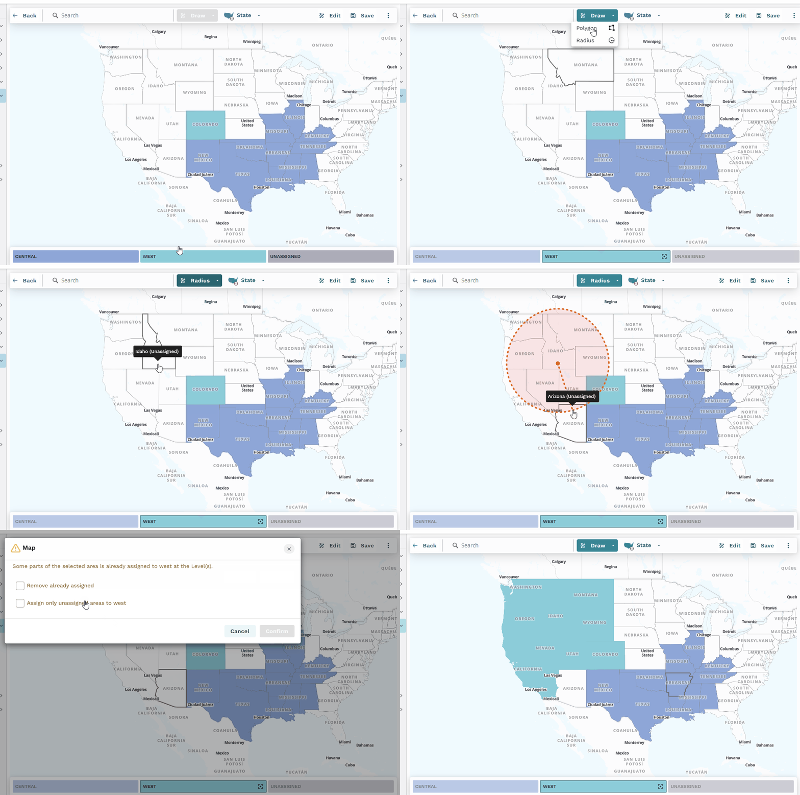
If your selection (via point-and-click, polygon, or radius) includes an area already assigned to a different territory, the system will prompt you to confirm whether you want to reassign it or exclude it from your current selection.

Draw radius
Use this method to select all geographic areas within a circular range from a central point.
Click the desired territory segment at the bottom of the map.
Select the Map Zoom Level you want to assign.
From the Draw dropdown on the map interface, select Radius.
Click on the map where you want the center of territory.
Drag your mouse outwards to define the radius of the territory.
Click again to finalize the area.
Note
All geographic areas falling within the defined radius at the selected map zoom level will be assigned to the active territory.

